However, this
particular outbreak is the one to which my visit to Eyam in the Peak District
National Park relates to.
The bubonic plague
took Eyam’s first victim, tailors assistant one George Viccars on 7th September
1665 and its last victim, Abraham Morten on 1st November 1666. In that period
of fourteen months, some 260 people died within the village!
I will apologise
in advance. Eyam is so full of history; I’ve not covered a lot, but seem to
have written a lot. I hope you find what I’ve written as fascinating as I have
when undertaking my research before going live with this blog.
I won’t go in to any
great detail about the plague days, for there will be too much to cover, but I
can strongly recommend reading up on how the village of Eyam coped with the
plague.
The story is; a
chest of clothing arrives at the house where George Viccars was staying with
clothes from London. Upon opening it, he observed an obnoxious odour, which
found the clothes to be damp.
This in itself was
not the cause of the bubonic plague, but what the clothes harboured was, fleas!
It was the flea
that feasted on the blood of the black rat found its way to feast on human in
the absence of its host, the black rat.
To help contain
the bubonic plague, Rev’d
William Mompesson set about a plan to control the plague. That was; to
basically quarantine the village by isolating itself from the rest of the
country, to close the church to reduce the spread of the plague with in the
village and the final but probably the least pleasant, was to bury their own
family members on their own land!
Could you imagine
having to bury your family members, with plague ravaged bodies, at the bottom
of your garden?
 |
| Map showing The Delf in relation to Eyam |
The church during
those days held a very prominent place in everyone’s lives, so to close the
church would be cutting off a lifeline for the villagers. So Rev’d William Mompesson
arranged an alternative location, The Delf, located to the south west of Eyam,
between the village and Middleton Dale.
To briefly
continue, as part of this quarantine, the village needed to bring certain items
in and also send certain items out, to survive. This had to be done without
spreading the plague and this is where Mompesson's Well came in to its own.
Here, it provided a drop off and pick up point for Eyam, allowing the exchange
of goods without any contact from the villagers to the outside world.
Coins were soaked
in vinegar to disinfect them in a bid to stop the spread of the plague….
This story was
covered in a play, The Roses OfEyamThe Roses Of
Eyam, which was televised on BB2 in 1973, which I recall watching as a
child.
I would love to
see that play again……
Now, some of you
may be thinking about the nursery rhythm “Ring a Ring a Roses” for which there
are a few variations of.
There is no
confirmed relationship between the bubonic plague and the nursery rhythm, but I
often wonder?
For these little
lines of verse are often born out of some even, be it local or wider spread….
However, I’ve
picked this one;
“A ring, a
ring o' roses,
A pocket full o' posies-
Atishoo atishoo we all fall down. “
My thoughts, the
ring of roses, the ringed scab as a result of the flea bite,
“Atishoo atishoo”, the sneezing
associated with the bubonic plague and finally, “We all fall down”, the final curtain.
After a lot of
searching on the web, I didn’t manage to find a satisfactory explanation to the
line “A pocket full of posies-“
Especially with
all the variants of the nursery rhythm that are around….
One final thing
before I move on to the walk, Eyam Well
Dressings, as with many Peak District villages has a dresses three wells
and blesses them, which is held at on the last Saturday of August each year.
I have never
visited Eyam before, but it’s been a long time on my list of places to visit.
As a result of my initial research I kept the walk very short, so I could spend
some time in the village of Eyam.
I’m pleased I did
keep the walk short, though I do need to return to the village and dedicate
more time to the history that surrounds it.
Now that brief and
exciting history lesson is written, now to the very short, but extremely
pleasant walk, from Eyam on to Eyam Moor and back.
Parking in Eyam
isn’t too bad; there are three car parks to choose from, there is the one by
Eyam Museum, which is Pay and Display, there is one at the back of that, which
is free, though there is a donation honesty box, and the third is the National
Trust Car Park for Eyam Hall.
 |
| Entrance to the free car park |
 |
.... "If you use the free car park,
please donate some money towards its upkeep" .... |
 |
| .... "note the time the gates are locked" .... |
If you use the
free car park, please donate some money towards its upkeep. The surface is very
good and looks fairly freshly laid.
Also, note the time the gates are locked, for
you don’t want to return and find your transport home locked in for the night!
Anyway, parked up,
suited and booted, I set off on my walk for Eyam Moor. As I leave the car park,
turn right on to Hawkeshill Road, follow the road as it bends right on to Edge
Road and pass the Youth Hostel on your left.
 |
| Edge Lane heading towards the Youth Hostel |
 |
| The sign for Eyam Youth Hostel |
 |
| .... "after the Youth Hostel, on your left is a footpath through the wooded" .... |
Soon after the
Youth Hostel, on your left is a footpath through the wooded area, ascending up
toward Eyam Moor. Here you reach an unnamed road, where you turn left then
after about thirty metres on your right, you pick up the footpath to continue
walking on to Eyam Moor.
Here you are
afforded a nice view from the road down to Eyam.
 |
| The end of the footpath through the wooded area |
 |
| Ladywash Mine |
As you follow the
footpath there is a set of old mine buildings on your right, Ladywash Mine, which was closed around 1979,
where fluorite was mined. Fluorite
is a colorful mineral, visible
in normal and ultraviolet light. It has many uses, including ornamental and industrial.
One of fluorites uses is a flux for
smelting.. Did you know that the purest grades of fluorite are used as a source
of fluoride for hydrofluoric acid manufacture?
 |
| Looking down on to Eyam |
 |
| Crossing Sir William Hill Road |
 |
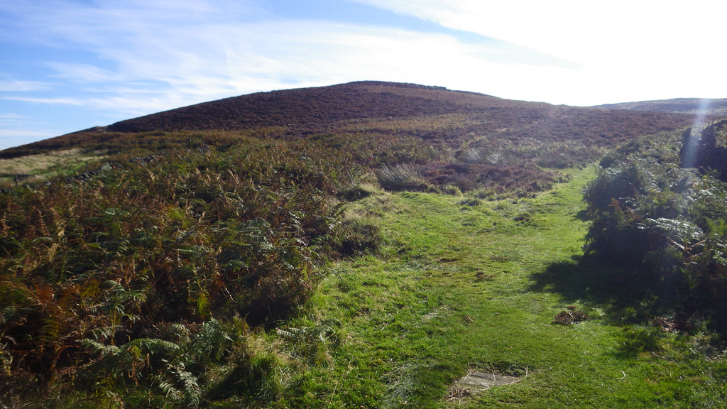
| On to Eyam Moor |
Also over to the east on the horizon is
Stanage Edge which dips down to Upper Burbage Bridge and then back up to Higger
Tor.
I have walked over to Higger Tor and
Carl Walk from Stanage Edge, but that was before my blogging days.
Follow the footpath; you come to
another road, Sir William Hill Road, where you cross over to the next style,
where you enter Eyam Moor properly.
Follow the
footpath northwards and you walk past the radio mast on your left, by which
there is a trig point. It’s worth diverting to the trig point, for on a clear
day you are given fabulous views around the White and Dark Peaks.
 |
| Trig Point on Eyam Moor |
After taking in
the views, head back to the path and continue in a northerly direction reaching
the point at which you start to descend.
Soon after returning to the path, you come across some stone ring cairns, which may have been dwellings at some point.
 |
| Ring Cairns, that may have been dwellings |
As I descended, my original plan was to continue to Stoke Ford. Head east and circumnavigate Eyam Moor and take in Wet Withens Stone Circle.
I had a dilemma at
this point, I wanted to take in Eyam Moor in its entirety but knowing what I’m
like with sightseeing and photographing just about everything, I had to cut the
walk short so I could spend time in Eyam.
However, that
would have made for insufficient time in Eyam, so at the gate GR SK 213 788, I
took the path that hand railed the stone wall back up towards a point called
Stanage (stanage meaning rock edge).
 |
| The path leading down to the gate at GR SK 213 788 |
 |
| The gate at GR SK 213 788 |
 |
| The path leading away from the gate, to hand rail the stone wall on the east |
Continuing along
this path in a southerly direction, I was afforded fabulous views over to
Hathersage, Grindleford, Stanage, Big and White Edge Moors, all mentioned
earlier and of course, Eyam Moor itself.
 |
| Looking over Wet Withens and Hathersage |
 |
| The end of the path on Eyam Moor |
 |
| Edge Road in front, Sir William Hill Road to the right |
 |
| Edge Road back to Eyam |
At the junction,
you have a road to your right, Sir William Hill Road, which will take you back
to the point where you ascended out of Eyam towards the mast and trig point,
left takes you to Grindleford and straight one is Edge Road, the road which the
Youth Hostel is on, so from here, you can’t get lost.
However, the trail
around Eyam starts very soon……
Walk down Edge
Road and you pass Ladywash Farm and Ladywash Mine, then as you walk over the
brow of the hill, you start to descend in to Eyam.
Before the first
right turn, you reach Mompesson’s
Well, which is basically a horse drinking trough more than a water source
for humans.
 |
| White Edge Moor |
 |
| Big Moor and Froggatt Edge |
 |
| Ladywash Mine |
Walking back up to
the road, turn right to continue towards Eyam and about 45 metres from the next
junction, there is a footpath amid the trees on your left.
Take this footpath rather than carry straight
on, for it gives you a circular tour through Eyam rather than going straight
back to the car park past the Youth Hostel.
It is a steep
descent in to Eyam, giving you a nice gradual ascent back to the car park
through the beauty of Eyam and its history.
Eventually, you reach
the village of Eyam. From here you can continue in to the village or take the
first left, the B6521, named New Road and seek out Riley’s
Graves, seven graves and a sacred memory to the Hancock family.
 |
.... "Walking back up to the road, turn right to continue towards Eyam
and about 45 metres from the next junction,
there is a footpath amid the trees on" ....your left |
 |
| .... "Eventually, you reach the village of Eyam" .... |
Walk up this road,
where you will come to a forked junction. Take the left for, Riley Lane and
eventually you reach another forked junction. Take the right fork, for the left
fork is a private drive to Riley House Farm.
Continue along the
lane and soon, you see an opening, in that opening is what appears to be a
stone paddock. That paddock is Riley’s
Graves, seven graves belonging to the
 |
| The sign giving you instructions how to reach Riley's Graves |
 |
| The start ofRiley's Lane |
 |
| Heading up Riley's Lane to Riley's Graves |
 |
| Take the right fork along Riley's Lane |
 |
| Riley's Lane leading to Riley's Graves |
 |
| The paddock comes in to view, enclosing Riley's Graves |
 |
| The paddock wall enclosing Riley's Graves |
 |
| Riley's Graves, the seven Hancock family graves. |
Riley’s
Graves, as with the vast majority of graves from the plague, were not in a
churchyard on consecrated ground, but on the land of the Hancock family who
lived there.
Before I go any
further, some references to the Hancock family have an ‘e’ on the end of the
surname, making it ‘Hancocke’. However, I’ve opted to use the National Trust
signage which doesn’t have the ‘e’ on the end.
If you watch the
YouTube video Eyam
plague -the story it will give you a little more insight in to where the
house would have stood and why the graves are there.
Just a word of caution, you can
drive up Riley Lane, but turning round might be extremely difficult, so if you
can walk, or cycle, then I would advise that.
Back to the lane and turn right
to head back in to Eyam. Here you back track to B6521 and head for the village
centre.
Ideally you want to head right,
in a south westerly direction, aiming for Church Street. Here you will
eventually reach St Lawrence Church, a very
ornate church, particularly inside.
 |
| St Lawrence Church, Eyam |
 |
| Looking to the alter inside St Lawrence Church, Eyam |
 |
| O~ne of the wall drawings inside St Lawrence Church, Eyam |
As mentioned
earlier, there will not be many graves pertaining to the plague victims, due to
Rev’d William
Mompesson closing the church and requesting families dig graves on the own
land to reduce the spread of the plague.
However, there is
one grave and a memorial in the church yard. The grave of Catherine Mompesson,
the wife of Rev’d
William Mompesson who died of the plague August 25th 1665 and a memorial to
Rev’d Thomas Stanley, who supported Rev’d William Mompesson
during the plague isolation times of Eyam.
 |
| Catherine Mompesson's Tomb, St Lawrence Church, Eyam |
 |
| The memorial to Rev'd Thomas Stanley, St Lawrence Church, Eyam |
Walk out of the
churchyard through the gate on the right and you immediately reach the Plague
Cottages.
Here saw the first
victim of the plague, tailors assistant George Viccars, who died on 7th
September 1665, mentioned at the start of this blog.
Continue along
Church Street and you teach Eyam Hall (National Trust), built after the plague
as a wedding present for John Wright in 1671.
Follow the road
round and you arrive at the village green.
 |
| Plague Cottages, Eyam |
 |
| Eyam Hall |
 |
| Eyam Village Green with stocks |
Once you’ve spent
some time at the village green, continue along the road up towards Eyam Museum.
I can strongly
recommend visiting the museum, for it not only covers the plague era, but post
plague mining boom for lead, galena, fluorite and much more.
One bizarre item
by today’s standards was the Beak Mask worn by physicians
of the day!
 |
| Plague Doctor with Beak Mask |
However, they were none the wiser, in a God fearing period, often many sought repentance and saw the bubonic plague as a sign that they had sinned!
What I will say is, hard it will have been, but how much their efforts at isolation saved many of the surrounding villages and the hardship it will have created. Not just the isolation, but burying their own family members.
Its hard enough when we have to say good bye to our loved ones, but to bury them on your own land, must have taken great courage.
I can only
apologise if I’ve rambled on, but Eyam is so full of history, it just had to be
shared with you. I hope you’ve found it as interesting as I have. There is much
more to be found, both in print and on the web.
Below are a few of
the links I’ve referred to, with many more, being too numerous, not listed.
I am going to
return to Eyam and also one day, walk the full walk originally intended.
Finally, happy
rambling and thank you for reading,
Peak
Rambler
References
Blogs I’ve written mentioned


I do like a nice bit of history on a wander. It's a while since I've been around Eyam and the surrounding areas; looks like you had a nice day.
ReplyDeleteThere's a couple of ghost stories associated with both Eyam and Eyam Moor - got them in a book somewhere.......
I'll happily let you know, it was nicely mind blowing the research I did on Eyam and the plague. I had to pull myself away and get on with the writing, or it would never have got published!
DeleteThere are some very good books about the ghosts and legends of the Peak District, with lots of fascinating stories in.
A detailed description of a lovely spot in the Peak District. Some nice photos too; I went walking in the Eyam area on Saturday, unfortunately it rained all day.
ReplyDeleteThank you Lee, it was a fabulous day.
DeleteAnother excellent post Mike, I thoroughly enjoyed reading that. it has been about 20yrs since I last visited Eyam on a school trip, I think it's about time I returned. thanks for sharing, all the best
ReplyDeleteThank you Dean.
DeleteI need to go back there and spend more time on the moor. The views from the moor are fantastic, over to Stanage, Bamford Moor, Mam Tor and the ridge, Kinder, Bleaklow and even Derwent Edge.
There are also the Lydgate Graves in Eyam where George and Mary Darby are buried, the tomb of Humphrey Merrill, the grave stone of Abel Rowland who lived and died in Eyam Tea Rooms and the Boundary Stone. And in Bretton there are some graves belonging to the Morton, Hall and Townsend Families who died from the Plague and one grave in Bretton Clough. I am going to Eyam and Bretton tomorrow. How long did it take u to walk to Eyam Moor and back?
ReplyDeleteThank you Charlotte for taking the time to read and comment.
DeleteI'm sure you can imagine before I published this, I did quite a lot of research, and I still am looking into many points not covered in the above.
I'm also grateful to you sharing some information which I haven't published.
The actual walk I kept short, mainly because I wanted to spend time in Eyam and capture some of the villages rich history, knowing there will be a lot I wouldn't be able to include.
From memory, I think the walk, including lunch, was about five hours. But, I did spend a lot of time stopping, taking photos and absorbing the fantastic views I was blessed with.
I hope that gives you an idea of time scales.
I intend to return one day, once my leg has fully healed after a motorist mangled my lower right leg. But that won't happen before autumn 2017, by that time I should be walking again.